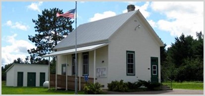
Planning Commision
Minutes, August 5, 2024
Plan Commission & Task Force Minutes
Town of Washburn
Town Hall
Monday, August 5, 2024
Commission members present: Kim Bro (chair), Cyndi Belanger (secretary), Jim Park (town board representative) , Tim Schwenzfeier (vice chair), Caroline Twombly.
Commission members absent: none.
Planning Task Force members present: Terri Bahe, Tom Cogger, Phil Kraus, Dennis Weibel.
Planning Task Force members absent: Charmaine Swan, Marieke Van Donkersgoed.
Others present: none.
-
Chairman Bro called the meeting of the commission to order at 7:05 P.M. and verified its legal notification (posted at town hall and Tetzner Dairy) and on town website on July 31.
-
The minutes of the July 8, 2024 meeting were approved (Tim moves, Cyndi seconds).
-
Phil Kraus is a new member of the Plan Update Task Force, and he and the group introduced themselves.
- The members of the commission and Plan Update Task Force discussed steps to encourage public awareness and participation in the process of updating the comprehensive plan. Jim Park will lead the development of a “Plan Update” tab on the town’s plan commission webpage that, in addition to meeting minutes, will provide background information that the group is reviewing to update the plan. Phil Kraus will design a ⅓-page insert to be included with a September mailing to all town residents. Our plan is to have these efforts ready for approval by the next meeting on September 9.
- The group reviewed the “Agricultural and Natural Resources” elements of the current (2007) plan. The plan asserts that a significant amount of existing agricultural lands classified as “prime,” “statewide importance,” locally unique,” and “locally important” needs to be preserved to insure the existence of viable farms in the town. Even so, none of the town’s agricultural lands are enrolled in the county’s farmland preservation program, and there are no disincentives to converting agricultural lands to rural residential lots. The number of parcels 20 acres or less in Range 5 West of the town have increase from 5% of the land area to 12% from 1985 to present. While the plan calls for concentrating rural residential development on the east side of the town (closer to transportation corridors), there is no such pattern in the fragmentation of parcels that has occurred.The group agreed that specific measures toassure preservation of larger parcels (>20 acres) are needed in the updated plan. These measures may include voluntary easements or zoning for larger minimum lot sizes.
- The group also reviewed lands identified in the “Future Land Use Map” as “Sensitive Areas.” The “General Soils Map” in the plan shows these steep ravines, floodplains, and wetlands that are critical to the health of trout streams in the town. The plan says “these areas are subject to erosion problems and are generally unsuited for development.” However, except for state land acquisition largely prior to 2007, no steps have been implemented to prevent the fragmentation and development of these lands. The county no longer seeks town board input regarding the granting of residential building permits on agricultural and forested lands. In general, the county grants building permits for structures more than 75 feet from the edge of a stream, and the only notice provided to towns is after a permit is granted. At best the town can provide guidance on the construction of a driveway. In the town driveway permitting process, the town informs land owners of the sensitive characteristics of the land they wish to develop. No measures are in place to inform owners in advance of their acquiring land in sensitive areas about the uses for which the property is best suited.The group agreed that the plan should identify specific steps toretain large, forested parcels in “Sensitive Areas” and to prevent fragmentation and rural residential development.The amount of industrial forestland at the headwaters of the Sioux River has decreased from 15% of Range 5 West in 1985 to 12% currently. Each time a new company takes ownership to total industrial forest area decreases. If more individual 40-acre parcels were put up for sale, large, contiguous blocks of forest habitat at the headwaters of the Sioux River and Thompson Creek would be lost. The group recommended that the town ask to county Forest & Parks Department to work with the forest owner to
assure that the remaining blocks of forest remain whole, either through continued enrollment in the state Managed Forest Law or through county acquisition.
- The group reviewed the “Transportation” chapter. Terri noted that the Bay Area Rural Transportation (BART) system now is available for requested pickups of “shut-in” residents who need transportation to places on the bus routes (hospital, clinics, and shops). However, transportation is dominated by residents using personal cars and trucks. The current plan says little about future town investment in road development. Jim noted that the town’s five-year road plan calls only for maintaining existing paved roads and not for increasing the amount of paved roads. Because of the increasingly high cost of road maintenance, the group proposed making such a policy explicit. Because expansion of paved roads is expensive. New rural residential development is best located near existing paved roads.The group discussed the increase in bicycling as a positive development. Engoe, Nevers, Wannebo, Ondossagon, Wannebo, Church Corner, and Paulson roads are all marked as bicycle routes on the Ashland-Bayfield County Bicycle Map (2014). Part of the attraction of these roads for bicyclists is the “scenic, rural road” experience as opposed to the experience on state and county highways. There is a hazard posed by increasing both motor vehicle use and bicycle use in a single lane with no paved shoulder. The group encouraged taking steps to make paved town roads safer for bicycles without having to make major investments in expanding the width of the roads. Rather the group encouragedreducing the speed limit on these roads to 45 mph and posting “Share the Road” with bikes and pedestrians signs. The group recommends promoting non-motorized use of town roads in the future at the same time as it recognizes the financial and aesthetic limits to expanding the amount of pavement.The group also encouraged a policy to
discourage increasing the mileage of town roads. If multiple residences are built on a shared driveway, the town should be clear that the driveway will remain a private expense, and the town road network will not be expanded. The town driveway ordinance should be enforced to assure adequate access for emergency vehicles.
- Kim mentioned that the City of Washburn tested clay being excavated from the Bayfield Street project and determined that an adequate amount of suitable material is available to repair the clay cap of the closed landfill. The group said that the importance of perpetual protection of groundwater recharge areas should be made more prominent in the updated plan.
-
The meeting adjourned at 8:43 P.M. (Cyndi moves, Tim seconds).
Draft submitted by: Kenneth Bro, Chair, Town of Washburn Plan Commission (August 6, 2024).
‘
Plan Commission Report
The commission recommends including a ⅓-page insert in the town’s September mailing to make residents aware of the process to update the plan and to encourage community engagement in updating the plan.
Plan Commission Meeting Monday August 5 2024 7:00 pm
Town of Washburn
Plan Commission Meeting
Date &Time: Monday, August 5, 2024, 7:00 P.M.
Location: Town Hall*
Agenda
- Call meeting to order and verify legal notification.
- Approve minutes of meeting of July 8, 2024.
- Third meeting of Comprehensive Plan Update Task Force. Review “Natural Resources and Agriculture” and “Transportation” chapters of town and county plans.
Review trend in fragmentation of private lands.
● Identify private forestlands most important for watershed health.
● Identify prime agricultural lands.
● Identify options for managing roads and improving transportation. - Preparing a postcard mailing to residents about updating the plan
- Closed landfill update: the city can provide clay to repair the cap.
- Set date and time for next meeting (propose Monday, September 9, 2024, 7:00 P.M.).
- Other announcements
- Adjournment
Submitted by:
Kenneth Bro, chair
Washburn Town Plan Commission
75411 Church Corner Rd.
Washburn, WI 54891
Cell: 715-292-0034
E-mail: kbro1151@gmail.com
Minutes, July 8, 2024
Plan Commission & Task Force Minutes
Town of Washburn
Town Hall
Commission members present: Kim Bro (chair), Cyndi Belanger (secretary), Jim Park (town board representative) , Tim Schwenzfeier (vice chair).
Commission members absent: none.
Planning Task Force members present: Tom Cogger, Caroline Twombly, Dennis Weibel.
Planning Task Force members absent: Terri Bahe, Charmaine Swan, Marieke Van Donkersgoed.
Others present (at meeting): Kodi Drinken.
Others present (at site visit): Kodi Drinken (permit applicant).
-
Chairman Bro called the meeting of the commission to order at 7:00 P.M. and verified its legal notification (posted at town hall and Tetzner Dairy) and on town website on June 29.
-
The minutes of the June 4, 2024 meeting were approved (Cyndi moves, Jim seconds).
-
Prior to the meeting at 6:20 P.M., the commission conducted a site visit with Kodi Drinken at his residence (29490 County Hwy C). The level property is on sand-over-clay soils. While the sand currently is firm, Tim noted that his experience in building nearby is that, with very shallow depth to the water table in spring, an emergency vehicle would easily bog down in the soil off of the driveway. An area of load-bearing material (13-foot x 12-foot wide (east) with 25-foot turning radius sides) is needed on the east side of the existing paved driveway apron to provide an adequate tee turnaround. The commission advised Kodi to submit a driveway permit application agreeing to provide an extension for the tee. There are some plantings of trees and shrubs between the house and the county highway. Several smaller plantings near the highway appear to be recent.
- The commission reviewed the county Class A Special Use Permit Application for Kodi and Amanda Drinken to use their house as a short-term rental unit on their 10-acre parcel in an Agriculture 1 zoning district (E½E½SE¼SW¼ Section 26 T.49N R.5W; Tax ID #31008; 29490 County Hwy C).The commission reviewed the conditions that the county Planning and Zoning Committee will ask the county board to approve later this month (no excessive noise, no fireworks, occupants limited to capacity of sanitary system, no recreational vehicles campers or tents for more occupants, a 24-hour contact person on file in case of problems, and compliance with all state and local regulations. In addition, the county health department conducts annual reviews regarding state health requirements and requires annual renewal of county permits. The commission recommends (Cyndi moves, Tim seconds) that the town board recommend approval of the short-term rental permit contingent on meeting the requirements listed in the proposed amendment to the county zoning ordinance section on short-term rentals and on the applicant providing a tee turnaround to assure sufficient access for emergency vehicles. The commission also recommends (Tim moves, Cyndi seconds) that the town board require the owner to apply for a town driveway permit agreeing to provide a tee turnaround as specified at the site visit.
- The members of the commission and Plan Update Task Force reviewed historical population and housing data and projections to 2040 for the town, the City of Washburn, nearby towns, and Bayfield County. The population of the city is projected to decline 12%. The town population is projected to increase 10%, and the county is projected to increase 16%. The number of housing units is projected to increase (town: 22%, city: 7%, and county:14%). The proportion of elderly residents is increasing. The implications is that there will be more houses with fewer residents per house, increasing needs for senior citizens, and fewer working-age residents to provide services to a dispersed, elderly population. With the expansion of broadband internet, there will be more residents who want a rural lifestyle and who can work remotely from home. There also appears to be an increasing trend of either multigenerational households or of parents, children and grandchildren living in close proximity. The current zoning preference of five acres per household is tending to lead to greater fragmentation of private forest and agricultural lands. A barrier to attracting younger residents is the lack in our area of affordable housing for rent of for first-time buyers.
- The group also discussed the relationships between the town and nearby cities. The cities provide employment, shopping, commercial and industrial services, schools, libraries, and community centers. Our town is a source of forest products, wildlife, fisheries, agricultural produce, natural scenery, and outdoor recreation – not just for residents, but also for urban dwellers near and far. These resources not only serve residents but contribute significantly to the tourist economy of the region. Tourist demand for short-term rental houses is one of the barriers to longer term rental housing. While the town roads are used increasingly by ATVs and UTVs, there also is an opportunity to provide greater opportunities for bikers and hikers. There are permanent off-road trail networks for motorized vehicles, but the Washburn area does not have an equivalent of the Bayfield Area Trails network. The privately owned soccer fields in the town are an indication of the possibility for increasing community gathering and recreational activity in the open spaces provided by our town.
- Kim mentioned that the City of Washburn will draft a request for bids to excavate more clay for the closed landfill from the town’s previous clay source area and for restoring the landfill cap. The town requested bids for mowing this summer.
- Kim mentioned that the town board approved a postcard mailing to residents in August to invite more community engagement in the plan update process. The town also approved a MailChimp notification of those who wish to be informed of the planning meetings. Kim shared the Ashland Photo Challenge example of community members submitting photos of “Things of which we are proud,” “Things we should keep,” and “Things that can be improved.”
- Cyndi announced that US Representative Tom Tiffany is seeking support for a proposal to make the Apostle Islands National Lakeshore and National Park. It was not clear what the real benefits of the proposal are.
-
The meeting adjourned at 8:43 P.M. (Tim moves, Cyndi seconds).
Draft submitted by: Kenneth Bro, Chair, Town of Washburn Plan Commission (July 9, 2024).
‘
Plan Commission Report
The commission recommends that the town board recommend county approval of the Class A Speicial Use Permit for Kodi and Amanda Drinken to have a short-term rental with the conditions proposed for the county zoning ordinance amendment for short-term rentals and with providing adequate driveway access for emergency vehicles.
Plan Commission Meeting Monday July 8, 2024 7:00 pm
Town of Washburn
Plan Commission Meeting
Date &Time: Monday, July 8, 2024, 7:00 P.M.*
Location: Town Hall*
Agenda
- Call meeting to order and verify legal notification.
- Approve minutes of meeting of June 4, 2024.
- Review applications for town driveway permit and county Class A Special Use Permit for short-term rental for Kodi & Amanda Drinken on their 10-acre parcel in an Agriculture 1 zoning district (E½E½SE¼SW¼ Section 26 T.49N R.5W; Tax ID #31008; 29490 County Hwy C).
- Second meeting of Comprehensive Plan Update Task Force. Review “Issues & Opportunities” and “Housing” chapters and “Community Facilities” section of town and county plans.
Review population and household data and projections.
● Discuss town’s role regarding community services. - Closed landfill update: posted a bid for mowing and preparing a bid for repairing clay cap subsidence
- Community postcard mailing, mail chimp notices & web page approved by town board.
- Set date and time for next meeting (propose Tuesday, August 6, 2024, 7:00 P.M.).
- Other announcements
- Adjournment.
* Commission members will conduct a site visit at 6:20 P.M. prior to the meeting.
Submitted by:
Kenneth Bro, chair
Washburn Town Plan Commission
75411 Church Corner Rd.
Washburn, WI 54891
Cell: 715-292-0034
E-mail: kbro1151@gmail.com
Minutes, June 4, 2024
Plan Commission & Task Force Minutes
Town of Washburn
Town Hall
Tuesday, June 4, 2024
Commission members present: Kim Bro (chair), Cyndi Belanger (secretary), Jim Park (town board representative).
Commission members absent: Hallie Sandberg, Tim Schwenzfeier (vice chair).
Planning Task Force members present: Terri Bahe, Tom Cogger, Charmaine Swan, Caroline Twombly, Marieke Van Donkersgoed, Dennis Weibel.
Others present (at meeting): Kurt Kiehne.
Others present (at site visit): Mike Harvey (town road superintendent), Elizabeth Post (permit applicant).
-
Chairman Bro called the meeting of the commission to order at 7:00 P.M. and verified its legal notification (posted at town hall and Tetzner Dairy) on May 31, 2024 and on town website on May 30.
-
The minutes of the March 10, 2024 meeting were approved (Cyndi moves, Jim seconds).
-
Prior to the meeting at 6:15 P.M., the commission conducted a site visit with Elizabeth Post at her property (76151 Paulson Rd). Elizabeth had placed wire flags to mark the perimeter of her proposed driveway with a tee turnaround west of a proposed 1-story home. The drive will extend to a proposed shop building east of the house. The proposed driveway and buildings are on a relatively level former glacial beach on a buried glacial moraine. It connects to a steep, existing private access road off of Paulson Rd. The hillside consists of sand-over-clay soil that is highly erodible, and the owners of the private road have had to take frequent measures to minimize gullying of the road ditch. The owner proposed constructing a catch basin at the uphill side of the drive entrance with flow across 2‑4” rock at the driveway apron. Mike Harvey felt that the proposed road ditch design would wash out in a heavy rain. Instead, he recommends a 18”x40’ culvert in an angle from the road ditch at the uphill side to the owners property on the downhill side. To prevent gullying at the culvert outlet, the owner should construct a 6.5’x 8’ check dam structure. The forebay at the outlet should be lined with a heavy nonwoven felt fabric that will withstand a rock lining around the edge and allow runoff to seep into the soil without washing the sandy surface soil.. The rock at the downslope end should distribute runoff evenly across the 6.5’ edge so that the natural ground cover at the outlet will hold the soil in place. The driveway should have an “outsloped design” that allows spring melt water to flow evenly across the driveway rather than be captured in a driveway ditch. The purpose is to maintain the natural sheet flow of runoff across the sandy landscape without forming gullies.
- The commission reviewed the driveway permit application and preliminary development plan for Elizabeth post on her 8.3-acre parcel in a Forestry-1 zoning district ((parts of SW¼SW¼ + NW¼SW¼ Section 33 T.49N R.5W; former Tax ID #31158 across from 76165 Paulson Rd). The proposed driveway extends 290’ northeast from a north-south private access road. The owner proposes 6” base of 2-minus gravel that will be compacted as construction occurs. After construction of the buildings, 4” of medium well-graded, crushed, fractured rock will be added. Rather than the driveway entrance design specified on the permit application, the commission recommends a culvert with end walls and downslope end protection as recommended above by the town road superintendent. Because the proposed driveway connects to an especially steep portion of the private access road that is subject to gullying in heavy rain, the commission recommends that the town board make permit approval conditional on the owner promptly repairing any washout that may occur at the driveway entrance. The design recommended by the superintendent is expected to slow the erosiveness of road ditch runoff, but some additional measures may be required to maintain accessibility to residences farther uphill.With these recommended changes, the commission recommends (Jim moves, Cyndi seconds) that the town board approve the driveway permit. Because the proposed buildings are set back approximately 300 feet from Paulson Road with a hillside forest between the road and the house, the project will retain the forested character of the area (Policy 8.1.e). Because the roadbed and buildings are set back from the steep edge of the terrace of transitional soils, the plan accommodates the potential for slumps (pp.7-22, 8-24). Because the proposed construction area is a relatively level former glacial beach of sand over clay with much natural ground cover vegetation, the proposed project, with the recommended modifications should accommodate the drainage, visibility, and roadbed requirements of the Town Driveway Ordinance.
- The members of the commission and Plan Update Task Force introduced themselves. They reviewed the purpose of the comprehensive plan: retain the rural character of the town; protected the high quality streams and forests, retain agricultural lands, focus residential development near paved roads closer to Highway 13, and retain the neighborliness of a small town.The group also discussed handouts Kim had distributed regarding the community planning process and experience with the current plan. Kim noted that the creation of the town plan commission and the review process for driveways and land use decisions are the primary means for implementing policies. The primary failure of the plan has been in the fragmentation of agricultural and forest land into parcels that are too small for agriculture and forestry. Typically, the creation of parcels of less than 20 acres occurs before the town is made aware of their creation. The only lands that are limited to more than a 4.5-acre minimum size are publicly owned forest lands. Currently, the town has not implemented any steps to limit the fragmentation of forested and agricultural lands.
Tom mentioned that another dimension of “rural character” is retaining dark night skies. This policy likely was not included in the current plan because the plan committee did not know how to implement it. Kim mentioned the “Action Steps” page that the City of Bayfield used when it updated its comprehensive plan. Such an approach gets around the nebulous “ongoing” timeline listed in the “Implementation” chapter of the town’s current plan. One “action steps” example from the City of Bayfield is “creating a unified network of walking trails.” In that case, much of the leadership for the policy comes from a volunteer citizen’s group. There are creative ways for the town to implement policies without increasing the burden on elected officials.
- The group approved the schedule of future meetings for updating the comprehensive plan: Monday, July 8, Tuesday, August 6, Monday, September 9, Tuesday, October 1, Sunday, November 10, Tuesday, December 3, Tuesday, January 7, 2025, and Tuesday, February 4 (all at 7:00 P.M. at the town hall. There may need to be some revisions if we are unable to have a quorum of plan commission members or if conditions required for site visits require a change. Each meeting will address about two chapters of the plan. The updated county plan can serve as a point of comparison for updating the town plan. The goal will be to bring Northwest Regional Planning Commission consultants into the process in the fall and to have a plan ready for a public hearing by February 2025.
- The group reviewed the results of the community survey conducted for the plan in 2006 and discussed whether there now may be more effective and dynamic methods Now that the town has a website and a system of notifying community members of town events, it may be possible to create a “Plan Update” tab, and to notify community members of key issues about which the task force is seeking public input. There may be issue fact sheets to brief community members and specific feedback requests (e.g., Survey Monkey) to solicit community perspectives. The task force discussed mailing a postcard notice to all resident households to gather email addresses of those who wish to stay informed and engaged in the task force’s work. Kim will ask the town board about available options.
- Kim announced that he and Doug Belanger estimated that 3,000 cubic yards of clay are needed to repair the closed landfill cap.
-
The meeting adjourned at 8:37 P.M. (Cyndi moves, Jim seconds).
Draft submitted by: Kenneth Bro, Chair, Town of Washburn Plan Commission (June 10, 2024).
‘
Plan Commission Report
The commission recommends that the town board approve the driveway permit for Elizabeth Post contingent on installing a 40’x18” culvert from the upslope road ditch on the private access road to the owner’s property downslope with a check dam at the outfall. The commission also recommends that approval be contingent on the owner agreeing to install any additional measure to slow runoff and prevent gullying if future heavy rains cause a washout at the driveway entrance.
The commission recommends that the town board approve creating a ‘Plan Update” tab on the town’s website and approve a postcard mailing to town residents in late summer to facilitate email notification of key planning issues and actions.
Plan Commission Meeting Tuesday June 4, 2024 7:00 pm
Town of Washburn
Plan Commission Meeting
Date &Time: Tuesday, June 4, 2024, 7:00 P.M.*
Location: Town Hall*
Agenda
- Call meeting to order and verify legal notification.
- Approve minutes of meeting of March 10, 2024.
- Review driveway permit application and development plan for Elizabeth Post and Sam O’Brien on their 8.3-acre parcel in an Forestry 1 zoning district (parts of SW¼SW¼ + NW¼SW¼ Section 33 T.49N R.5W; former Tax ID #31158 across from 76165 Paulson Rd).
- Initial meeting of Comprehensive Plan Update Committee. Review purpose of plan, draft schedule for updating plan, and previous community survey..
- Set date and time for next meeting.
- Announcements
- Adjournment.
* Commission members will conduct a site visit at 6:15 P.M. prior to the meeting.
Submitted by:
Kenneth Bro, Chair
Town of Washburn Plan Commission
75411 Church Corner Rd.
Washburn, WI 54891
Cell: 715-292-0034
E-mail: kbro1151@gmail.com
.
Minutes: March 10, 2024
Plan Commission Minutes
Town of Washburn
Across from 29945 Wannebo Road
Sunday, March 10, 2024
Members present: Kim Bro (chair), Cyndi Belanger (secretary), Jim Park (town board representative), Hallie Sandberg, Tim Schwenzfeier (vice chair).
Others present: Mike Harvey (town road superintendant), Adam Vlasaty (owner’s agent/contractor).
-
Chairman Bro called the meeting of the commission to order at 4:20 P.M. and verified its legal notification (posted at town hall and Tetzner Dairy) on March 6, 2024 and on town website.
-
The minutes of the November 5, 2023 meeting were approved (Tim moves, Hallie seconds).
-
Prior to the meeting at 4:00 P.M., the commission conducted a site visit with Adam Vlasaty, the owner’s contractor. According to the contractor the adjoining property owner (Kevin and Jacquie Tetzner) had agreed verbally that morning to a land trade that would extend the Kebbekus property westward in return for an equal amount of the east portion of the Kebbekus parcel. The Tetzners own neighboring property on both the east and west sides of the Kebbekus parcel. The proposed driveway would enter the Kebbekus property at the west boundary and extend to a proposed structure (32’x48’) in the southwest corner of the parcel west of a ravine containing a tributary of Thompson Creek, a Class I trout stream. The entire area of the parcel and adjacent land is level, forested clayey soil and steep ravines of clayey slopes. The entire area is wooded with second-growth trees and shrubs.
- The commission reviewed the driveway permit application and preliminary development plan for Katherine and Peter Kebbekus on their 5-acre parcel in an Agriculture 1 zoning district (S½SE¼SE¼SE¼ Section 2 T.48N R.5W; Tax ID# 30587 NW of Wannebo Rd at Bjork Rd.). The owners propose a driveway base of 2-minus gravel topped with six inches of medium well-graded, crushed, fractured rock. A 40-foot x 18-inch diameter culvert is proposed for the road ditch. The proposed a tee turnaround would extend onto the property to be acquired from the adjacent landowner. The commission determined that the proposed layout would meet the drainage, visibility, roadbed, and turnaround requirements of the driveway ordinance. The layout is sufficiently distant from the ravine to protect the vulnerable slopes (Policy 8.2.a) and accommodates the erodibility of the clayey soils (Plan pp.7-22 & 8‑24). Because the owners will retain a natural vegetative screen between the proposed building and the town road, the proposed development will maintain the scenic, forested character of the area (Policy 8.1.e). The commission recommends that the town board approve the application (Cyndi moves, Tim seconds), contingent on the acquisition of the adjoining land to the west, providing a 40’x18” culvert in the road ditch and providing a 2-minus gravel base over the clayey soil.
- Kim mentioned that the town board is seeking a source of clay soil to fill the depression in the landfill’s clay cap.
- The commission discussed informational the handout Kim excerpted from University of Wisconsin specialists on steps to assure safe development near erodible clay bluffs such as that near streams in the town. It provides advice that is not encompassed by current state and county regulations.
- Kim mentioned that, now that the update of the county comprehensive plan is complete, the Northwest Regional Planning Commission will contract to assist the town with its update in the fall of 2024. Meanwhile, the town can hold community meetings to identify the key revisions needed for the plan.
- The commission selected Tuesday, April 2, 2024 7:00 P.M. for the next meeting at the town hall. If there is business to be conducted.
-
The meeting adjourned at 4:55 P.M. (Hallie moves, Cyndi seconds).
Draft submitted by: Kenneth Bro, Chair, Town of Washburn Plan Commission (March 12, 2024).
‘
Plan Commission Report
The commission recommends that the town board approve the driveway permit for Katherine and Peter Kebbekus contingent on the acquisition of the adjoining land to the west, providing a 40’x18” culvert in the road ditch and providing a 2-minus gravel base over the clayey soil..
Plan Commission Meeting Agenda Sunday March 10, 2024 4:30 PM*
Town of Washburn
Plan Commission Meeting
Date &Time: Sunday, March 10, 2024, 4:30 P.M.*
Location: Outdoors across from 29945 Wannebo Rd.*
Agenda
- Call meeting to order and verify legal notification.
- Approve minutes of meeting of November 5, 2023.
- Review driveway permit application and development plan for Katherine & Peter Kebbekus on their 5-acre parcel in an Agriculture 1 zoning district (S½SE¼SE¼SE¼ Section 2 T.48N R.5W; Tax ID# 30587 NW of Wannebo Rd at Bjork Rd and across from 29945 Wannebo Rd).
- Set date and time for next meeting.
- Announcements
- Adjournment.
* Commission members will conduct a site visit at 4:00pm prior to the meeting.
Submitted by:
Kenneth Bro, Chair
Town of Washburn Plan Commission
75411 Church Corner Rd.
Washburn, WI 54891
Tel: 715-292-0034
E-mail: kbro1151@gmail.com
Minutes, Nov. 5, 2023
Plan Commission Minutes
Town of Washburn
Town Hall
Sunday, November 5, 2023
Members present: Kim Bro (chair), Jim Park (town board representative), Tim Schwenzfeier (vice chair).
Members absent: Cyndi Belanger (secretary), Hallie Sandberg.
Others present: Sandy Raspotnik (town chair), Connie Cogger, Becky Brown, Michael McKenna, Rebecca Lawrence, Nate Rudolph, Gina Park.
Present on Google Meeting: Hans & Lauren Dahl
-
Chairman Bro called the meeting of the commission to order at 5:00 P.M. and verified its legal notification (posted at town hall and Tetzner Dairy) on November 2, 2023 and on town website.
- At 4:00 P.M. prior to the meeting, the commission conducted a site visit for the driveway permit application of Craig Johnson to install a driveway on his 5.6-acre parcel in a Forestry 1 zoning district (~S½ SE¼ SE¼SE¼ Section 32 T.49N R.5W; Tax ID # 39119; south of the private driveway leading to 76135 Paulson Rd.). Mr. Johnson met with the commission for the site visit. The forested property is on relatively level sand‑over‑clay soils (2-6% slope) that drain north to a Class 2 trout stream that is tributary to the Sioux River. Mr. Johnson had placed wire flags indicating the proposed location of the driveway and the area to be cleared on either side. He placed flagged rebar indicating his preliminary plan for the location of a garage (21’x25’) and a house (33’x25’). No culverts will be needed, and the proposed turnaround tee provides an adequate turning radius and distance for emergency vehicles. The proposed development is more than 300 feet from Paulson Road with much natural forest screening between the proposed development and the road.
- At 4:30 P.M. prior to the meeting the commission conducted a site visit for the county Class B Special Use Permit application of Hans & Lauren Dahl for adding a 75’x100’ pole building for “building contractor equipment and material storage” southeast of an existing 75’x100’ pole building and 35’ west of the east property line of their 10.5-acre parcel in an Forestry 1 zoning district (part of W½NE¼SW¼ south of Paulson Rd Section 33 T.48N R.5W; Tax ID#: 35562; 76440 Paulson Rd). Hans’s father Severt met the commission members at the site. The Dahls have removed trees and placed many truckloads of sand over the sand‑over‑clay soil (~10% slope) to create a level site for the proposed additional storage building. There are motion-activated exterior lights without shields that glare into the adjacent properties. At this time, there are no erosion control measures on the fill to prevent the fill from eroding after construction of a building when the future roof drips to the east side of the property. Runoff at the site seeps into surface sand and flows through the soil to the south east. There is erosion control silt fencing at the edge of the property approximately 35 feet from the fill. There is a swale between the fill and the property line. At this time, with no impervious surfaces on the building site, there is no indication of gullying.
-
The minutes of the September 11, 2023 meeting were approved (Tim moves, Jim seconds).
- The commission recommends (Tim moves, Jim seconds) that the town board approve the driveway permit for Craig Johnson. The proposed layout meets the drainage, visibility, roadbed, and turnaround requirements of the driveway ordinance. The layout is not expected to affect erodibility or seeps of the transitional (sand-over-clay) soils, and the significant natural vegetation between the site and Paulson Road will retain the forested character of the area.
- There was significant discussion among attendees of Hans and Lauren Dahl’s county application to add a second storage building for the business on the property where the duplex homes for them and Hans’s father are located (see attached written comments submitted prior to the meeting). Comments related to 1) business-related traffic increasing wear and dust on Paulson Road, an unpaved road, potential offsite runoff from the roof of the new building, the noise from the back-up warning of trucks, light pollution from exterior security lights, and illegal, residential use of the current building. Hans said that most of the recent heavy traffic at their property is related to bringing in fill for the proposed building. He said that the added storage building would allow the company to place indoors many vehicles currently visible from Paulson Road. He said that in 2014 he planted many white pine seedlings between the road and the current building, but they have not grown enough to create a natural vegetative screen between the town road and the building. Hans said there was a previous use of the current building as a residence, but no residential use has occurred after the duplex was built. He said that the exterior security lights are connected to motion sensors, but the sensors have to be reset after a power outage to prevent them from remaining on continuously.Kim mentioned that the town board recommended approval of the original Class B Special Use Permit in 2014 noting that the business would be a good addition to the town. Bro noted that there are other building contractors with pole buildings in Forestry‑1 zoning districts in the town, and there are other residents who operate several business-related vehicles from pole buildings on their home properties. Tim said that, in addition to his long-time, building contractor business on Hove Lane, there is Bob Olson’s sand pit that uses the unpaved road. He expects that the traffic level on Hove Lane is comparable to, if not greater than, the traffic on Paulson Road. Jim said that, while the town is responsible for road maintenance, it cannot dictate how much the public traffic is allowed to use town roads. Several unpaved town roads receive frequent use and wear.
Kim mentioned that the County Planning and Zoning Committee decides on the issuance of Class B Special Use permits. The town board only can make recommendations to the county regarding the permit. Kim mentioned that the Bayfield County Zoning Ordinance lists “Building Contractor Equipment and Material Storage” as a use that may be permitted in a Forestry‑1 zoning district if specific, measureable conditions listed in the ordinance can be met.
The commission discussed with the Dahls permit conditions that they would accept: 1) place erosion control along the east dripline of the roof to prevent the fill from eroding at the back of the new building, and establish a dry swale between the building and the property line so that roof runoff will seep into the sandy soil on-site and not create gullies extending from the site to neighboring properties, 2) add native shrubs between Paulson Road and the pole buildings that will more rapidly grow to provide a natural, vegetative screen along the road, 3) place shields and maintain motion sensors on all exterior lights so that lights shine downward around the buildings and is diverted from shining directly toward adjacent properties, and 4) maintain normal business hours for traffic and noise on site of 6:00 A.M. to 6:00 P.M. The Dahls are amenable to these conditions. The Dahls acknowledged that residential use of the pole buildings is not permitted.
The commission recommends (Tim moves, Jim seconds) that the town board recommend county approval of the Dahl’s Class B Special Use Permit application to construct an additional pole building provided that the four conditions listed above are met. With these conditions, the proposed project will encourage a local business that is compatible with the rural character (Goal 8.4), add natural vegetative screening appropriate for a forested area (Policy 8.1.e), and accommodate the erodibility of transitional (sand-over-clay) soils (pp.7‑22 & 8‑24).
- Kim mentioned that the public hearing on the updated county comprehensive plan will be at 6:00 P.M. on Tuesday, November 14 at the county board room. Many of the elements in this updated plan are likely to be addressed in the update to the town’s comprehensive plan. The town will be contracting with Northwest Regional Planning Commission to update the town plan. The regional planning commission assisted the county in updating its plan.
-
The commission selected Sunday, December 3, 2023 3:30 P.M. for the next meeting if site visits are required.
-
The meeting adjourned at 6:00 P.M. (Tim moves, Jim seconds).
Draft submitted by: Kenneth Bro, Chair, Town of Washburn Plan Commission (November 14, 2023).
‘
Plan Commission Report
The commission recommends that the town board renew approval of the driveway permit for Craig Johnson. The commission recommends that the town board recommend county approval of the Class B Special Use Permit for Hans & Lauren Dahl to add a second pole building (75’x100’) southeast of their existing pole building for “building contractor equipment and material storage” provided that four conditions are required to enhance natural screening, control potential erosion and surface runoff, reduce off-site glare of lights, and maintain normal business hours within 6:00 A.M. and 6:00 P.M.
Plan Commission Meeting Sunday November 5, 2023 5:00 PM
Town of Washburn
Plan Commission Meeting
Date &Time: 5:00P.M., Sunday, November 5, 2023.*
Location: Town Hall
- Call meeting to order and verify legal notification.
- Approve minutes meeting of September 11, 2023.
- Review driveway permit application for Craig Johnson on his 5.6 acre parcel (~S½ SE¼ SE¼SE¼ Section 32 T.49N R.5W; Tax ID # 39119; on the driveway leading to 76135 Paulson Rd.
- Review County Class B Special Use Permit for Hans and Lauren Dahl to expand their building contractor equipment and material storage by adding another 75’x100’ pole building on their 10.5-acre parcel in an Forestry 1 zoning district (part of W½NE¼SW¼ south of Paulson Rd Section 33 T.48N R.5W; Tax ID#: 35562; 76440 Paulson Rd). Note: the building location and driveway layout has changed from that shown on the previously approved town driveway permit application.
- Discuss county updated comprehensive plan public hearing on November 14 at 6:00pm in the county board room at the county courthouse.
- Set date and time for next meeting. Propose: Sunday, December 3 2023, 3:30 P.M. if visits required
- Announcements
- Adjournment.
* Commission members will conduct site visits beginning at 4:00pm at the Johnson property prior to the meeting.
Join via Google Meeting:
meet.google.com/qfj-baox-adp
Submitted by:
Kenneth Bro, Chair
Town of Washburn Plan Commission
75411 Church Corner Rd.
Washburn, WI 54891
Cell: 715-292-0034
E-mail: kbro1151@gmail.com