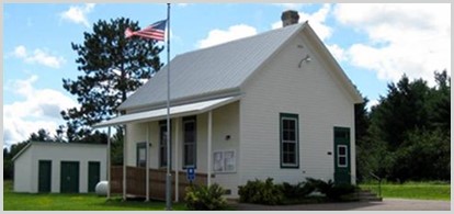
Minutes, October 1, 2024
Plan Commission & Task Force Minutes
Town of Washburn
Town Hall
Tuesday, October 1, 2024
Commission members present: Kim Bro (chair), Jim Park (town board representative), Tim Schwenzfeier (vice chair) , Caroline Twombly, Cyndi Belanger (secretary – via Google Meet).
Commission members absent: none.
Planning Task Force members present: Terri Bahe, Phil Kraus, Charmaine Swan.
Planning Task Force members absent: Tom Cogger, Dennis Weibel.
Others present: none.
-
Chairman Bro called the meeting of the commission to order at 7:05 P.M. and verified its legal notification (posted on town website and at town hall and Tetzner Dairy on September 30).
-
The minutes of the September 9, 2024 meeting were approved (Tim moves, Caroline seconds).
- The group reviewed the “Land Use” section of Chapter 8 of the current (2007) plan. Kim had copied the “Existing Land Use” map from the updated county comprehensive plan, added existing buildings, and marked some corrections that were not included in the county map. Kim also copied the current county zoning district map. What stands out from these maps is that there is much less actively farmed agricultural land in the town than what was proposed in the town’s “Future Land Use” map from 2007. The group agreed that active farming is a significant element of what gives the town its “rural character” that most residents consider a key attraction of living in the town as opposed to a “rural residential” landscape that features only a low density residential landscape without farms and unfragmented forestlands. In some parts of the town, agricultural fields have been replaced by rural residential developments. The current zoning districts are considerably different from the existing land use. Areas that are now rural residential areas are in agricultural zoning districts. Many of the areas that previously were farms are now forestland.
The group discussed what steps might be implemented to retain large areas of agricultural lands. In the Town of Bayfield several orchards placed permanent conservation easements on their agricultural land in order to prevent higher levels of taxation that occurs on land s that could be converted to residential subdivisions and to benefit from state tax incentives for protecting prime agricultural lands. Some counties (such as Dunn County) have adopted prime agricultural land zoning districts under the state prime agricultural land preservation program. This program limits the extent to which residential development can occur on an agricultural parcel to a maximum of 5% of the original parcel. The program encourages communities to permit creation of smaller lots (smaller than the current 4.5-acre minimum lot size) so that residential development can be clustered and most of the good agricultural land can be retained. Kim mentioned that this approach to zoning is called “performance zoning.”
The group also discussed what steps might be implemented to retain unfragmented blocks of private forestland. 1) The state’s Managed Forest Law provides tax incentives for owners to retain a minimum of 20 acres of contiguous forest of which at least 80% is dedicated to growing commercial timber products. There is a penalty for removing property from the program, but there is no guarantee of retaining the land as unfragmented forest. 2) The state’s prime agricultural land preservation zoning (mentioned above) could also apply to forestlands. 3) Bayfield County could acquire the large block of industrial forestland at the headwaters of the Sioux River. The county recently acquired a block of land at the headwaters of Whittlesey Creek that is near the national forest but not adjacent to existing county land. 4) The town could recommend that lands currently enrolled in the state’s Managed Forest Law program be zoned as Forestry‑2, which requires a minimum lot size of 35 acres. The only county lands currently in F‑2 districts are publicly owned lands. 5) The county could place forest establish a zoning “overlay district” for the areas shown in the town’s 2007 “Future Land Use” map as “sensitive areas.” These are highly erodible, steep slopes and floodplain areas critical to the health of trout streams. The overlay district could specify a larger minimum lot size for parcels in sensitive areas.
- The announcement “Your Voice, Our Future” promoting community engagement in updating the town’s comprehensive plan was included in the town’s September mailing to all town residents. It laid out several ways for people to keep informed and become involved in the planning process. It also highlighted the new plan commission tabs on the town website.
- Kim asked group members to select which chapter of the plan for which they would take responsibility to update the goals, objectives, and implementation steps. He mentioned that a key aspect of the updated plan is to identify specific steps and a timetable for implementation. The implementation section of the 2007 plan listed “ongoing” for many implementation steps. The lack of specific actions and a timeline for implementation limits the usefulness of a plan. There were no volunteers for writing updated drafts. Rather, members said they could review and revise drafts of updated chapters,
- Kim mentioned that he had not yet received a contract for planning services from the Northwest Regional Plan Commission. He will follow up to get a contract to the town board so that the group can get plan assistance in November. He emphasized the importance of having the draft plan available for a public hearing and consideration by the town board by March 2025.
-
The meeting adjourned at 8:30 P.M. (Tim moves, Caroline seconds).
Draft submitted by: Kenneth Bro, Chair, Town of Washburn Plan Commission (October 14, 2024).
‘
Plan Commission Report
If a contract for planning services to update the comprehensive plan is available prior to the October town board meeting, the board will need to act on it in order to update the plan this winter.
